


PRECINCT CLINTON TOWNSHIP, Vinton County, Ohio
About
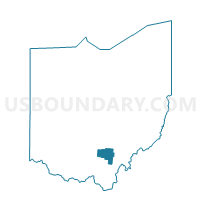
Outline

Summary
| Unique Area Identifier | 652951 |
| Name | PRECINCT CLINTON TOWNSHIP |
| County | Vinton County |
| State | Ohio |
| Area (square miles) | 31.05 |
| Land Area (square miles) | 30.17 |
| Water Area (square miles) | 0.88 |
| % of Land Area | 97.17 |
| % of Water Area | 2.83 |
| Latitude of the Internal Point | 39.18384370 |
| Longtitude of the Internal Point | -82.48458250 |
Maps


Graphs
Select a template below for downloading or customizing gragh for PRECINCT CLINTON TOWNSHIP, Vinton County, Ohio


Neighbors
Neighoring Voting District (by Name) Neighboring Voting District on the Map
- PRECINCT ELK TOWNSHIP, Vinton County, OH
- PRECINCT HAMDEN NORTH, Vinton County, OH
- PRECINCT HAMDEN SOUTH, Vinton County, OH
- PRECINCT MADISON TOWNSHIP, Vinton County, OH
- PRECINCT MILTON, Jackson County, OH
- PRECINCT RICHLAND SOUTHEAST, Vinton County, OH
- PRECINCT VINTON TOWNSHIP, Vinton County, OH
- PRECINCT WASHINGTON, Jackson County, OH
- PRECINCT WELLSTON 1-A, Jackson County, OH
- PRECINCT WELLSTON 2-A, Jackson County, OH
Top 10 Neighboring County Subdivision (by Population) Neighboring County Subdivision on the Map
- Wellston city, Jackson County, OH (5,663)
- Elk township, Vinton County, OH (3,306)
- Clinton township, Vinton County, OH (2,052)
- Richland township, Vinton County, OH (1,748)
- Milton township, Jackson County, OH (1,028)
- Washington township, Jackson County, OH (782)
- Madison township, Vinton County, OH (605)
- Vinton township, Vinton County, OH (548)
Top 10 Neighboring Place (by Population) Neighboring Place on the Map
Top 10 Neighboring Unified School District (by Population) Neighboring Unified School District on the Map
Top 10 Neighboring State Legislative District Lower Chamber (by Population) Neighboring State Legislative District Lower Chamber on the Map
Top 10 Neighboring State Legislative District Upper Chamber (by Population) Neighboring State Legislative District Upper Chamber on the Map
Top 10 Neighboring 111th Congressional District (by Population) Neighboring 111th Congressional District on the Map
Top 10 Neighboring Census Tract (by Population) Neighboring Census Tract on the Map
- Census Tract 9531, Vinton County, OH (5,466)
- Census Tract 9572, Jackson County, OH (5,037)
- Census Tract 9573, Jackson County, OH (3,576)
- Census Tract 9532, Vinton County, OH (2,957)